Town Pier
Primorje-Gorski Kotar County
Point Information
Captain Info
Captain Info for registered users
Get access to VHF channel, approach notes and more captain info.
Create a free account to access captain info for all locations.
Marine Conditions
24°
25°
7.5 kn
0.3 m
Sailing Conditions
excellentBest Sailing Windows
Thu 06:00 - 15:00
7.3kn / 0.4m
Thu 18:00 - 03:00
5.3kn / 0.2m
Fri 05:00 - 18:00
3.4kn / 0.1m
Beaufort
3 - Gentle breeze
Douglas
Smooth
06:43
19:09
Wind Protection
59%
Moderate protection. Avoid strong N, NE winds.
Thu26°/20°
11.9kn ESE
0.46m
Fri24°/19°
7.8kn ESE
0.2m
Sat25°/20°
3.9kn N
0.18m
Sun26°/21°
5.1kn NW
0.2m
Mon27°/22°
15.6kn N
0.84m
Tue23°/19°
15.9kn ENE
0.78m
Wed22°/17°
8.3kn ENE
0.66m
Thu
26°
11.9kn
Fri
24°
7.8kn
Sat
25°
3.9kn
🛠️ Services & Amenities
Electricity
Fresh Water
Restaurant
Shop
Buoy
Anchorage
Town Pier
Description
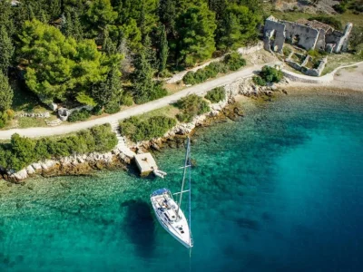
Osor is a town pier in Osor, Mali Lošinj, Cres, Croatia, located at coordinates 44.69295500°N, 14.39432100°E. The jetty is operated by the owner of restaurant "Adria" which is next to the bridge. Depth: 2.5m at the head, approximately 1m inside. Capacity: 60 berths for boats up to 20m length, maximum draft 2.5m. Many berths occupied by local yachts. Water and power available.
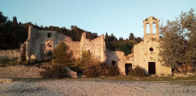
Historical Significance: This small town enjoyed its moment of glory in ancient times. City wall foundations show history traced back to 9th century BC. Osor is located where islands of Lošinj and Cres almost meet. Transit and navigation between seas made possible by man-made canal named Cavata, Kavuada or Cavanella. Main traffic current between North Adriatic and Dalmatia coasts passes here, making Osor an international port. Town name Osor-Apsoros thought to derive from ancient hero Apsyrt, brother of Medea. Contact: https://www.visitlosinj.hr/osor.aspx. Nearby services: Buoy, electricity, market, restaurant, water, anchorage.
Tip: Limited depth (1m inside) restricts larger vessels - check draft carefully. Contact restaurant "Adria" for berthing arrangements. The historic canal and ancient heritage make this a culturally significant stop. Many local boats occupy berths - arrive early or contact in advance.
Photos

Reviews (0)
Reviews
No reviews yet. Be the first to write one!